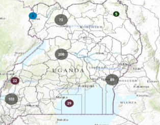
Last July, the Ugandan government initiated its first multi-donor geocoding exercise to map its Public Investment Management Information System – applying precise geographic coordinates to over 800 development project activities. With this geocoded data, the Ugandan government hopes to visualize who is funding what and where in their country to inform national development planning, improve coordination between development partners, and strengthen civil society interventions.
The geocoding work undertaken in Uganda was made possible through a partnership between Uganda’s Ministry of Finance, Planning and Development, AidData, and USAID’s Higher Education Solutions Network. Supporting this work from within the government as an Aid Management Fellow, I gained a unique first-hand perspective on several key takeaways for future geocoding initiatives.
1. Collecting data for geocoding is a long process
Many local development actors responded positively to the initiative and affirmed that geocoding Uganda’s development finance projects was important for the country. Our goal was to get information to the lowest administrative level possible, which required pursuing multiple data collection avenues through funding agencies, implementing partners, and project documents.
We worked closely with the government’s partners to collect data at the sub-county and village level, an exercise that had not been previously carried out in a systematic manner. Through this exercise, we realized that there is no guaranteed best method of geocoding data collection. It requires collaboration among stakeholders to generate the best set of information possible.
2. We have geocoded data - now what?
Maps are valuable. They synthesize large amounts of data into easy-to-use formats for many stakeholders. In the constantly shifting landscape of development aid, how can sustainability and accuracy be ensured?
A map is only as accurate as the process that produces it. If geocoding is to avoid merely being a snapshot and evolve into a sustainable tool for analysis and planning, a solidified data management plan must be put in place. We trained the government and partners extensively in the mapping software in order to ensure data capacity, and we discussed how this tool will benefit national development analysis and donor planning. A data management plan is now being finalized between various stakeholders, including an effort to involve line ministries and CSOs in the data process in order to further the scope of the data.
3. How can we measure the benefits of geocoded data?
Understanding the power of geocoded data is intricately tied to the benefits one derives from having that data. Geocoding is time consuming and expensive, and the benefits are largely intangible. How can we quantify these benefits? This is a question we constantly ask ourselves as researchers and producers of such data.
Perhaps geocoding aid data in Uganda will reduce future project duplication and misallocation of resources to the tune of millions of dollars in the future. Development partners may have easier access to national aid information than before, thereby reducing labor costs and increasing efficiency. Right now, we aren’t sure. Finding new qualitative and quantitative ways to measure these outcomes will create the incentives that stakeholders need in order to justify the costs of geocoding and sustainability of the data.
The future impact of this geocoding exercise is inextricably tied to its use. AidData will continue to support the government as it plans to integrate this data into decision-making and national planning. Geocoding is an important first step for the government to increase aid coordination and effectiveness, but there is still work to be done in order to ensure its uptake and sustainable use.
Stay tuned in the coming months as the government of Uganda prepares to launch the public version of its geocoded development finance data.