As a geocoder, I spent most of my time combing through copious project documentation looking for precise locations of development activities. Sleuthing for these valuable data points, it was easy to get lost in the details and lose sight of the fact that liberating data can have real-time impact. Last month, several AidData students and I put our GIS skills to work in mapping the Ebola outbreak as part of the MapGive Mapathon. A remote mapping event organized by the Humanitarian OpenStreetMap Team and the Red Cross, the Mapathon brought together 50+ volunteers to aid humanitarian relief respondents fighting the spread of the Ebola virus in West Africa.
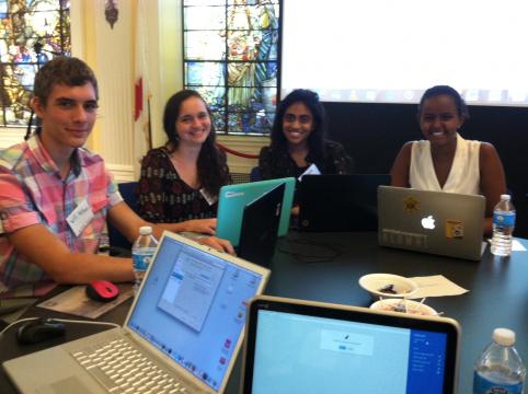
(AidData research assistants at the MapGive Ebola Outbreak Mapathon)
Since March 2014, the Humanitarian OpenStreetMap (OSM) Team has mobilized a powerful coalition of 1200 volunteer mappers from around the world to help humanitarian workers respond to the Ebola outbreak in a timely and efficient manner. A secret to OSM’s success is its easy to use platform that is accessible to first-time mappers, which makes it possible for a growing number of people to contribute to these efforts and even map an entire city with 20,000 buildings in a day. In combatting the spread of Ebola, volunteers have worked collaboratively to map 62,442 km of highways, 15,124 km of waterways and 500,000 buildings.
More importantly, these maps are being put to use by health workers and emergency responders on the ground in West Africa trying to meet the needs of people affected by the virus. For example, Red Cross workers that travel from one community to another to raise awareness about Ebola prevention have seen hard copies of maps distributed to health workers from various organizations. Doctors Without Borders has been using the maps to create data visualization on the spread of the epidemic to better allocate medicine and other resources and to coordinate field teams.
On the day of the MapGive Mapathon, the other volunteers and I received a short training, created an OpenStreetMap (OSM) account and were off and running. Once we selected a specific region of Sierra Leone or Liberia (in OSM this is a “square”), we traced and coded roads, houses, and schools based on satellite imagery. Once you finished one square, you moved on to another, and finally each completed area was reviewed before it went live. The mapping tool was so easy and fun to use that it felt very much like a game. The Red Cross staff also taught us how to use a new tool for quicker mapping: the JOSM editor. The most meaningful part of the experience was knowing that we were creating something that would actually be put to use only a few hours later.
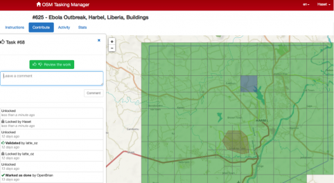
(OpenStreetMap dashboard: you pick a square on the map and contribute to the effort to locate roads and communities)
The fight against Ebola is far from over, but it is encouraging to see how combining crowd-sourcing and mapping tools, like OSM does, is one way to contribute to the solution. The effect of mobilizing people in response to the Ebola outbreak is already being felt, as detailed and updated maps equip organizations to more effectively and efficiently coordinate their response to the crisis.