AidData Summer Fellows
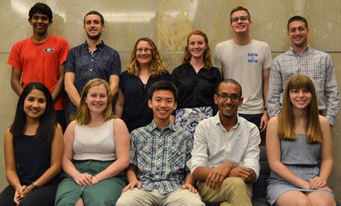
Funded through AidData’s five-year partnership with USAID from 2013-17, the AidData Summer Fellows program placed 87 students at fellowships in 10 countries to expand the use of geocoded data for development. Embedded with USAID country missions and local universities, think tanks, and civil society groups for two to three months, AidData Summer Fellows improved the capacity of governments and civil society in low- and middle-income countries to use geospatial data and analysis for program planning, advocacy and research.
Thanks to the generous support of the Robert and Susan Trice International Fellowship Endowment and the Freeman-Asia Award, the AidData Summer Fellows program has now transitioned to the Global Research Institute Summer Fellows Program. The Global Research Institute, a hub for interdisciplinary research on real-world issues, will continue to provide William & Mary students with hands-on international experiential learning opportunities through the new program.
To learn more, please visit the Summer Fellows Program page at the Global Research Institute's site. For questions, please contact the Assistant Director of Programs for the Global Research Institute, Rebecca Latourell, at rmhalleran@wm.edu.
2017 AidData Summer Fellows

Nirav Ilango | USAID/Nepal
Nirav Ilango is an undergraduate student at the University of Georgia, majoring in geography, computer science, and statistics. His background in geospatial analysis includes a previous position at the Carl Vinson Institute of Government, where he helped clean and standardize GIS data for UNOCHA, and a current position in the UGA Small Satellite Research Laboratory, where he is a team lead on UGA's inaugural effort to launch two environmental monitoring nanosatellites. Nirav's areas of interest include the use of spatial data in emergency response and disaster management, open-source mapping platforms, and imagery analysis. He will be working this summer at USAID/Nepal to apply advanced geospatial and data science processes to USAID/Nepal’s uptake of development aid.

Will Sheahan | Nepal Monitor
Will Sheahan is a rising senior studying Biology and Public Health at William & Mary. Over the last year, he has worked for AidData as a Research Assistant on the Geocoding team, and as a Senior Research Assistant on the Policy Team. In this capacity, Will collaborated with two other students to produce an innovative Social Vulnerability Index at the subnational scale in Colombia, and he is excited to continue using his interests in GIS and statistical analysis techniques to support making foreign aid practices more transparent and efficient. Will will be working at Nepal Monitor this summer to provide GIS support and training, as well as to contribute to geospatial analysis of data on human rights and security incidents.

Kevin Strybos | USAID/Peru
Kevin Strybos is an undergraduate student in the Geography Department at The University of Texas at Austin. His focus is on Geographic Information Systems and their use in analyzing data related to demographics and sustainable development. He has previously researched climate change and conservation politics in Botswana. Among other interests, Kevin enjoys learning about the factors that determine the varying cultural norms in human populations. Kevin will be working with the Monitoring & Evaluation group at USAID/Peru to increase GIS capacity, facilitate trainings, and provide analysis assistance.

Sarah Harmon | USAID/Philippines
Sarah Harmon is a rising junior at William & Mary majoring in International Relations with a minor in Middle Eastern Studies. She has worked as a Senior Research Assistant at AidData to track unreported international DFI finances as well as Syrian refugee migration patterns. She is a current Research Intern with the Project on International Peace and Security at William & Mary and is interested in pursuing a career in human rights or security issues in the Middle East. Sarah will be working with USAID/Philippines this summer to process new and existing datasets in ArcGIS and provide basic GIS training to mission staff and implementing partners.

Jack Zhang | Map the Philippines
Jack Zhang is an undergraduate student at William & Mary majoring in Government and Marketing. He has previously served as a research assistant on the Geocoding, Policy, and Survey Practice teams at AidData. During the past year, Jack has worked on projects such as Including Disabilities in U.S. Foreign Policy and the Diplomacy Lab Projects for the U.S. State Department. He participated in ITPIR’s "Shark Tank" competition in which he and two other students developed and carried out a project creating a Social Vulnerability Index for Colombia that identifies at a subnational level those populations most often left behind. Jack will be working with Map the Philippines to provide trainings in OpenStreeMap across Manila and promote youth involvement in mapping.

Daniel Aboagye | Economic Policy Research Center
Daniel Aboagye is studying international development as a Master of Public Policy student at William & Mary. He has a keen interest in the relationship between corruption, rent-seeking and foreign direct investment. Recently, Daniel has been working on research related to transparency and accountability in the 2016 general elections for Uganda. In the future, he hopes to apply an econometric approach to a career in advocating for good governance in the developing world. He will be working with Katherine Whitton at the Economic Policy Research Center (EPRC) to train staff on geocoding and spatial analysis processes and produce reports on development aid in the health, agriculture, and education sectors.

Hina Acharya | Open Sustainability Institute
Hina Acharya is a first-year Master’s student at the Lyndon B. Johnson School of Public Affairs at the University of Texas at Austin. She is in the Global Policy Studies program with policy interests in International Development and regional interests in South Asia and Africa. Prior to graduate school, Hina served as an English teacher in Nepal and as a student advocate for a non-profit in Omaha, Nebraska. Hina will be working with Paul Kuhne at the Open Sustainability Institute (OSI) to produce geocoded data on projects and interventions and train OSI staff and students on geospatial analysis.

Allison Bowers | Women of Uganda Network
Allison Bowers is a rising junior at William & Mary. She is double majoring in Government and Kinesiology and Health Sciences with a concentration in Public Health. Allison’s primary interests within these fields are global health, international development, and geographic information systems. This summer she will be working at the Women of Uganda Network (WOUGNET) to map target district progress in areas of operations, update existing databases, and run training sessions on mapping and data analysis.

Brittany Parowski | Right to Play
Brittany Parowski is a 2017 graduate from William & Mary with a degree in International Relations. Previously she has worked as a research assistant in William & Mary's Government Department and as an intern at the Department of State's Bureau of International Organization Affairs. Brittany will be working to evaluate Right to Play’s programs in schools across Uganda through on-site data collection and analysis.
Paul Kuhne | Open Sustainability Institute
Paul Kuhne is a first year Global Policy Studies student at the Lyndon B. Johnson School of Public Affairs at the University of Texas at Austin with a specialization in International Development. He has seven years experience in the nonprofit sector and received his BA in Political Science and Spanish from Temple University. At LBJ, he has focused on the Innovations for Peace and Development program, supporting their Data4Peace Colombia Hackathon, and cleaning data for a variety of projects. He’s interested in learning how to deploy data more effectively and transparently in order to help improve evaluation and program design in developing countries. Paul will be working with Hina Acharya at the Open Sustainability Institute (OSI) to produce geocoded data on projects and interventions and train OSI staff and students on geospatial analysis.

Katherine Whitton | Economic Policy Research Center
Katherine Whitton is a first year Masters of Global Policy Studies at the Lyndon B. Johnson School of Public Affairs at the University of Texas at Austin. There she studies the intersection of International Development and Governance and works with Innovations for Peace and Development. Prior to LBJ, Katherine was a Peace Corps Education Volunteer in Ethiopia ('13-'15). She will be working with Daniel Aboagye at the Economic Policy Research Center (EPRC) to train staff on geocoding and spatial analysis processes and produce reports on development aid in the health, agriculture, and education sectors.

Kerry Wong | USAID/Uganda
Kerry Wong is a PhD candidate at the London School of Hygiene and Tropical Medicine (LSHTM). Her research focuses on the socio-spatial inequality of health service provision and healthcare utilization in low- and middle-income countries. Before her PhD, Kerry gained a Master's degree in biostatistics from the University of Melbourne. She has also worked in different organizations, including the LSHTM and the WHO. Kerry’s main focus is data management and statistical analysis of secondary data to monitor progress towards health-related developmental goals. She has a keen interest in identifying opportunities to generate and apply geospatial data and tools to study international development and population health in low- and middle-income countries. This summer she will be working at USAID/Uganda where she will be working to provide GIS assistance across units and provide research assistance for the Mission’s Health team and public-health implementing partners
2016 AidData Summer Fellows

Lauren Cater | USAID/Peru
Lauren is a 2015 graduate of the Geography Master’s Degree program at George Washington University, where her studies focused on environment and development geography. She is interested in the use of quantitative and geospatial analysis for humanitarian purposes and for the evaluation of public policies relating to the environment, public health and international development. Lauren worked with the USAID/Peru Regional Program Office where she helped to maintain a database of USAID activities in Peru and to train members of their team to use GIS to support the Mission’s activities.
Raheem Chaudhry | Nepal Monitor
Raheem Chaudhry received a Master of Public Affairs from the Lyndon B. Johnson School of Public Affairs at the University of Texas. His research focuses primarily on political conflict in the developing world, particularly in the Middle East and North Africa. Before graduate school, he taught English at an elementary school with a Korean government program. Raheem holds his BA from the University of Maryland, where he majored in English Language and Literature and minored in Spanish. Raheem worked with Nepal Monitor to provide GIS support and training, as well as contribute to geospatial analysis of data on human rights and security incidents.
Catie Crowley | USAID/Senegal
Catie Crowley is a member of the Class of 2017 at the College of William and Mary majoring in International Relations. She is a Senior Research Assistant at AidData and works to track development financial flows from China and GCC donors. Catie is also a Research Fellow with the Project on International Peace and Security at William and Mary. Previously, she spent 10 weeks in Tanzania implementing an RCT impact evaluation of mobile phone ownership on female smallholder farmers with William & Mary’s Center for African Development. Catie worked with USAID/Senegal to produce geocoded data of mission activities and publish them on ArcGIS Online, assisted in the design of a spatial data management system, and collaborated with M&E specialists on covariate data gathering and analysis.

Caroline Davis | ANSA-EAP
Caroline Davis is a member of the Class of 2017 at William and Mary majoring in Economics and Mathematics. As a research assistant on the Reform Incentives Project (now AidData's Survey Practice Team), she was significantly involved in the implementation and analysis of the 2014 Reform Efforts Survey. Caroline also used GIS in the W&M Economics department to digitize historical maps of Java for the purpose of studying the effect of private land ownership on Java's long-term economic outcomes. She is interested in using spatial data to inform problems such as natural disaster resilience and relief allocation. Caroline worked at the Affiliated Network for Social Accountability in East Asia and the Pacific (ANSA-EAP) in the Philippines on their Citizen Participatory Audit project. She assisted in creating a platform for mapping government-funded infrastructure to help audit allocations for disaster response and mitigation.

Hannah Dempsey | USAID/Nepal
Hannah Dempsey is a 2016 graduate of the College of William and Mary with a BS and BA in Ecology & GIS and Environmental Policy respectively. She led the data visualization team at AidData and served as a virtual intern for USAID's Office of Transition Initiatives. Her GIS and remote sensing research includes studying Armenian fish farm proliferation, using the NDVI to examine global deforestation, and analyzing nighttime light changes over time as a proxy for human disturbance. In the next few years she hopes to perfect her cartography design skills and become a coding guru to automate her data aggregation. Hannah worked with USAID/Nepal to design and implement geospatial analyses using data from the Nepal's Aid Management Platform.

Caleb Ebert | USAID/Philippines
Caleb Ebert is a 2016 graduate of the College of William and Mary who majored in Interdisciplinary Studies with a focus on Public Health. His areas of interest include social epidemiology, vaccine-preventable diseases, and urban health. At William & Mary, Caleb was as a Senior Research Assistant for AidData's Geocoding Team. Caleb worked with USAID/Philippines to conduct spatial analysis, create thematic maps of projects and activities, and provide technical assistance.

Alex de Gala | USAID/Bangladesh
Alex de Gala is a 2016 graduate of the College of William and Mary majoring in International Relations and minoring in Chinese. His interest in international aid grew from working as a research assistant at AidData starting in 2014. He has conducted research in Bangladesh with the W&M student group BRIC (Bangladesh Relief Initiative for Change) and studied abroad in China for seven months. Alex worked with USAID/Bangladesh to conduct spatial analysis, create thematic maps of projects and activities, and provide technical assistance.

Sarah Martin | CERSGIS
Sarah Martin is a member of the Class of 2017 at the College of William and Mary with a self-designed major in Global Health Major. Sarah was on AidData’s geocoding team for more than a year, and has completed work on several independent mapping projects. Her interests include global public health, community development, and Geographic Information Systems. Sarah worked with Jason Ready at the Centre for Remote Sensing and Geographic Information Services (CERSGIS) in Ghana to locate and code development projects from local government records, conduct analyses of their project database for academic and policy-based research, and help provide training, technical backstopping, and mapping services to the National Development Planning Commission.

Haley McCoin | Nepal Monitor
Haley McCoin is a member of the Class of 2017 at the University of Texas at Austin, where she majors in International Relations specializing in Middle East Studies and Arabic language. Haley studied Arabic and Jordanian Diplomacy during the spring semester of 2016 in Amman, Jordan. At the University of Texas, she has been a research affiliate for the Conflict and Development team of Innovations for Peace and Development since the Fall of 2014, where she developed an interest in ArcGIS software and sub-national research on the relationship between conflict and humanitarian aid. In the future, Haley hopes to use her GIS background paired with her Arabic language skills to advocate for more effective forms of humanitarian aid to states in the Middle East and North Africa. As a Fellow, Haley worked with Nepal Monitor to provide GIS support and training, as well as contribute to geospatial analysis of data on human rights and security incidents.

Jason Ready | CERSGIS
Jason Ready is a member of the Class of 2017 at Clark University working toward an MS in Geographic Information Science for Development and Environment. At Clark, his work has focused on conservation modeling, development agriculture, and vegetation/landscape monitoring. Prior to graduate school he was employed in the energy sector doing database management and LiDAR processing/classification. His international experience consists of working as a Resource Manager in Ghana with the United States Peace Corps (2011-2013). Jason worked with Sarah Martin at the Centre for Remote Sensing and Geographic Information Services (CERSGIS) in Ghana to locate and code development projects from local government records, conduct analyses of their project database for academic and policy-based research, and help provide training, technical backstopping, and mapping services to the National Development Planning Commission.

Laura Richards | Women of Uganda Network
Laura Richards is a member of the Class of 2018 working toward a Master’s in Global Policy Studies, a Master’s in Business Administration, and a Certificate in Non-Profit Management at the University of Texas at Austin. Laura is a research affiliate with Innovations for Peace and Development and participates in the Open Aid and Asia Infrastructure Investment Bank teams. Laura is from Northern California and received her BA in Intensive Psychology from University of California, Santa Cruz. Before attending graduate school, she was a Program Supervisor at an inpatient facility for foster youth with behavioral and cognitive disorders. Laura is interested in international development, open aid data, and women and girls' education and empowerment. Laura worked for the Women of Uganda Network (WOUGNET) to map subnational areas in which Voluntary Social Accountability Committees operate, collect data through surveys to map membership and assess the extent of engagement, and train staff on geocoding methodology.

Paul Ryan | ISET-Nepal
Paul Ryan is a dual-degree Master’s student in Public Affairs and Middle Eastern Area Studies at the University of Texas with a concentration in Intelligence and Security. He is particularly interested in identity politics and hopes to work with NGOs in the Middle East, particularly those inside conflict zones. Paul worked at the Institute for Social and Environmental Transition - Nepal (ISET-Nepal) to assist with geocoding climate projects and creating vulnerability maps to assess whether community needs are being met.

Cleo Stern | Humanitarian OpenStreetMap Team
Cleo is a member of the Class of 2018 at the University of Texas at Austin where she is pursuing a dual Master’s Degree in Global Policy Studies at the Lyndon B. Johnson School of Public Affairs, and in Public Health at the School of Public Health. Cleo is interested in international development and health outcomes for vulnerable communities. Cleo is an avid Ultimate Frisbee player, and is originally from New York City. She worked for the Humanitarian OpenStreetMap Team (HOT) to perform spatial analysis on financial services locations in Uganda and create an interactive web map of HOT's overall global impact.
Ariel Walcutt | SERVIR-Mekong
Ariel Walcutt is a 2016 graduate of Clark University with an MS in Geographic Information Science for Development and Environment. Her research projects include studying land cover change in Tanzania, examining the relationship between coal industry activity and lung cancer in Appalachia, and classifying forest species using LiDAR and hyperspectral imagery in British Columbia. Ariel worked in Thailand with SERVIR-Mekong, a joint initiative between USAID and NASA, where she utilized GIS and Remote Sensing applications to examine environmental issues and their relation to development practices.

Evan Woods | ToroDev
Evan Woods is a Public Health major at Brigham Young University. He hopes to have a positive impact in the field by utilizing the skills and knowledge he's gained through his experience working with AidData at BYU. As a Fellow, Evan worked with ToroDev to integrate geospatial and in-field data to find effective and lasting improvements to the health and education services in Uganda.
Taylor Zevanove | Humanitarian OpenStreetMap Team
Taylor Zevanove is a member of the Class of 2018 at the College of William and Mary studying International Relations and Public Health. As an AidData Summer Fellow, she traveled to Uganda with the Humanitarian OpenStreetMap Team (HOT). Taylor worked with staff to perform spatial analysis on financial services locations in Uganda and to create an interactive web map of HOT's global impact.