Arriving for her first day of work in Manila, AidData Summer Fellow Caroline Davis didn’t know that she’d soon be the first person to ever apply geographic information systems (GIS) to the work of the Philippines’ National Disaster Response Committee (NDRC).
Created by the government after a series of devastating natural disasters, the NDRC was charged to survey areas most vulnerable to disaster, audit previous disaster response strategies, and identify strategies to improve disaster response. Caroline’s role was to show how GIS could be used to better understand the effectiveness of past response efforts, as well as how those responses could be improved in the future. Although the NDRC had never applied GIS to its work, staff quickly found it to be an indispensible tool, and now incorporate GIS analysis into their annual audit of activities and funding.
Stretched for time and financial resources, civil society, governmental and non-governmental organizations alike working in developing environments can find it costly to invest upfront in new technologies like GIS—even when such innovations would lead to improved performance and long-run savings. Funded through AidData’s five-year partnership with USAID, AidData Summer Fellows like Caroline are a valuable surge of technical support who enable these organizations to adopt and effectively use geospatial information, included geocoded aid data, for better development outcomes.
People power

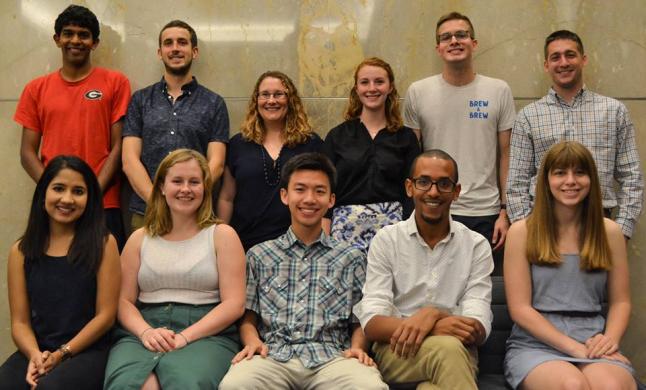
Embedded for 10 weeks each summer, Fellows provide the expertise and flexible manpower needed for these organizations to integrate geospatial data into their policy and program decision-making. The projects that Fellows undertake are diverse in scope and topic—check out what the 2017 Fellows are up to!—but all share the objective of increasing the use of geocoded data for organizations that otherwise would not have the capacity.
Other AidData Summer Fellows in countries around the world have found similar success to Caroline—like 2016 Fellow Hannah Dempsey, placed in USAID/Nepal to help the Mission better understand how Nepal’s mountainous terrain affects people’s access to important services. By weighting, combining, and scaling relevant variables (like elevation, slope, distance from roads and airports, land cover, and river/bridge presence), Hannah was able to build a visual index of remoteness that serves as a scale of accessibility across Nepal.
Knowing precisely where the most remote locations are and who is most affected by remoteness will help USAID/Nepal and other development organizations identify at-risk locations and populations based on accessibility and better target aid to them. This summer, Fellow Nirav Ilango built on Hannah’s work to improve the remoteness index by using an updated roads layer developed by Kathmandu Living Labs and OpenStreetMap.
Putting data on the map
In 2016, Fellows Sarah Martin and Jason Ready were embedded with CERSGIS, a non-profit in Ghana that provides geographic information and remote sensing services for development planning and resource management. At CERSGIS, Sarah and Jason led extensive professional trainings in GIS for Ghana’s National Development Planning Commission (NDPC), so government staffers could use GIS in their planning, policy, and monitoring and evaluation efforts.
According to CERSGIS Executive Director Foster Mensah, the AidData Summer Fellows were instrumental in getting the GIS unit off the ground. “The tremendous work done by Sarah and Jason at the NDPC in particular has resulted in the setting up a GIS Unit within the NDPC to work on district-level geocoding and other GIS-related activities,” said Mensah. With its new in-house ability to perform advanced spatial analysis, the NDPC can better ensure that its development projects are reaching the parts of the country that need it most.
AidData’s multi-year relationships with several host organizations have also allowed Fellows to follow up on long-term projects from summer to summer.
2015 Fellow Alex Kostura worked to geocode USAID/Peru’s entire active project portfolio, enabling the Mission to see all of their projects geolocated on a map for the first time. Alex also trained USAID/Peru staff to geocode new projects themselves, creating the infrastructure necessary to sustain the coding system over time.
The next summer, 2016 Fellow Lauren Cater further enhanced Alex’s effort. Using project data Alex and USAID/Peru geocoded, she explored the relationship between recent deforestation trends and the location of agricultural plots in the Peru Cocoa Alliance program, which provides resources to and encourages sustainability among small-holder cocoa farmers. Her graphical maps of USAID programs now help the organization visualize what’s happening to Peru’s forest cover in near-real time for better monitoring and evaluation.
Toward farther horizons
The AidData Summer Fellows’ achievements demonstrate that skilled students can have a significant impact on the capacity of development organizations to use geocoded aid information for improved results — especially within a short period of time.
Whether through supporting staff via trainings, helping prioritize projects that an organization would otherwise be unable to complete, or even introducing a new technology to a national planning committee, AidData Summer Fellows enabled by USAID have spread geocoded aid information and the tools for its analysis to the organizations that are most equipped to use it to improve their communities.
As the fifth year of AidData’s cooperative agreement with USAID draws to a close, a new gift will enable the fundamental work of the AidData Summer Fellows program to continue as it transitions into the new ITPIR Summer Fellows Program.
William and Mary alumni Bob Trice ’68 and Susan Saulmon Trice ’68 have made a generous million-dollar gift to fund endowments, internships, and fellowships at the Institute for the Theory and Practice of International Relations (ITPIR), AidData’s parent organization. The Trice gift will provide for up to eight William and Mary students a year to pursue summer fellowships abroad through AidData and other ITPIR projects, paving the way for future student impact.


