Today, we released AidData 3.0, an upgraded version of our development finance data portal at aiddata.org. Why does this matter? In my mind, there are three reasons. We’ve made it easier for everyone to explore and make meaning from development finance data to inform advocacy, decision-making and analysis. We’ve integrated data on remittances, foreign direct investment and other financial flows so that users are able to analyze aid within its broader context. Finally, we’ve expanded the geocoded data available to support more granular analysis of subnational aid flows and local development conditions.We’ve made data exploration easier for everyone. Thanks to burgeoning aid transparency and open data movements, stores of publicly available development finance data have dramatically increased in recent years. Yet, more data is not necessarily useful and information buried in voluminous project documents or in vast spreadsheets deters users from making meaning from development data. New dashboards, data visualizations, and maps available in AidData 3.0 bring to life static data previously contained in rows and columns. The option to export data using the International Aid Transparency Initiative (IATI) standardized format facilitates comparability between different sources of data. We’ve deliberately created a data sandbox with user-friendly tools for both techies and non-techies to leverage our data to explore the policy and research questions of greatest interest to them.
Let’s take maternal health in Malawi, for example – an issue of interest to a Minister of Finance managing a large aid portfolio, a donor working in a local field office, a researcher conducting a study, and to a citizen wanting to know what’s taken place in her community. Using AidData 3.0, I can compare aid project information from the World Bank, African Development Bank and Government of Malawi and contrast this with development indicators such as maternal mortality and population density to identify patterns of aid distribution relative to need. I don’t want to have to worry about whether the sector classifications from these different data sets match, or if my currency deflators are accurate. Fortunately, in AidData 3.0, it’s all done for me, with clear explanations. Instead, I can dive straight into my analysis. So, we’ve reduced the barriers to data exploration.

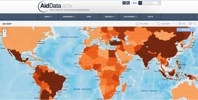
AidData 3.0 facilitates mashups of different data layers to enable new insights
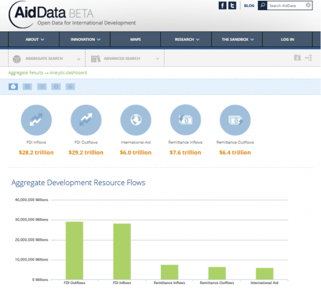
We’re also putting aid in its appropriate context. In the last 10 years, emerging donors have become key players in the development landscape. Financial inflows that influence policy priorities in developing countries have also diversified. Remittances have grown to be 1.5 times larger than aid flows, while foreign direct investment is roughly 7 times greater than aid. The domestic budgets of these countries have also seen significant growth. It is increasingly apparent that aid is far from the only game in town. When we look at aid flows in isolation, we are missing a large part of the picture of who else is doing what, where and to what effect.
In one interactive interface, users can now compare data on over $40 trillion in remittances, foreign direct investment, and aid from 90 donor agencies. Soon private foundation grants and domestic public expenditure from developing countries will also be added as it becomes available. With AidData 3.0, we can begin to put the pieces together to capture the broader universe of development finance and assess the degree to which aid is complementary to other financial flows.

Visualize aid within the broader context of development finance
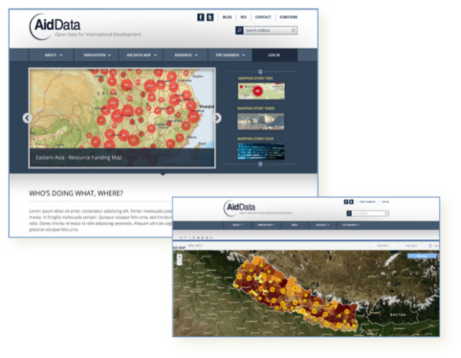
AidData 3.0 houses innovative new data sources like geocoded data. It matters where within a country aid is flowing and to which communities. The ability to localize development funding and socio-economic indicators is important not only for better aid targeting, but also because it makes development finance data relevant to local governments and civil society that want to see what is going on in their town, district or province. AidData 3.0 already incorporates granular, subnational data on all projects from the aid management systems of Malawi and Nepal. Over the next four years, AidData will geocode and publish subnational data on aid projects for several more countries in partnership with USAID’s Higher Education Solutions Network. A new state-of-the-art GIS interface allows users to create, save and share maps using this geocoded data.

The geocoded information in AidData 3.0 facilitates more granular analysis
As a research and innovation lab, AidData strives to push the limits of what seems possible. Whether shedding light on Chinese aid, contributing to the IATI geocoding standard, or empowering users with tools and data to unlock their own insights, we seek to make development finance more accessible, understandable, and actionable. There is a data revolution underway and we’re all a part of it. So, dive into AidData 3.0, combine data in new and different ways, and don’t forget to share your new creations and insights with others!
